Richard Mine at Mount Hope County Park, NJ
![[Sign for Richard Mine]](rich_sign.jpg) Photos of the Mount Hope Park in Morris County NJ. Site of the
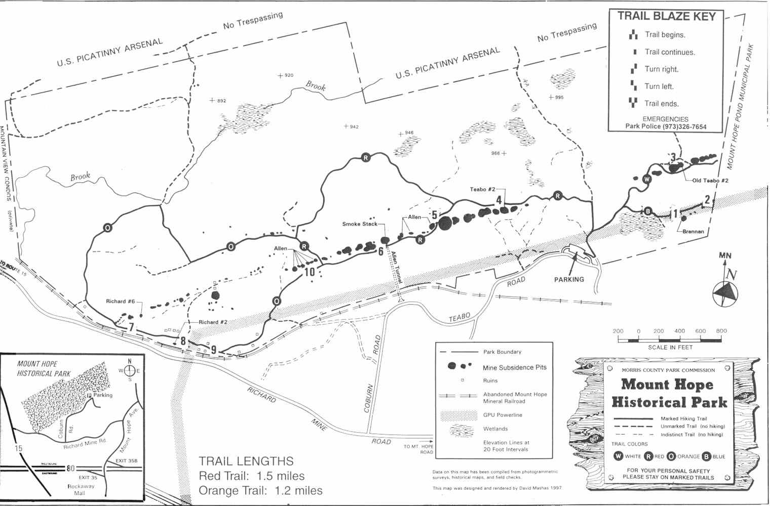
Richard Mine, one of a number of productive iron mines of the 18th thru 20th centuries in this park. Located adjacent to I-80 in Morris County. A map of the park is available from the brochures found at the park. The county Web site for the park is at this link.
Photos of the Mount Hope Park in Morris County NJ. Site of the
Richard Mine, one of a number of productive iron mines of the 18th thru 20th centuries in this park. Located adjacent to I-80 in Morris County. A map of the park is available from the brochures found at the park. The county Web site for the park is at this link.
This page was started in 2005. From time to time, I get some correspondence about my tours of the mine. and here's some of the information people have sent me or information they've requested. Links to relevant organizations are below.
I first visited the site in April 2005
IN the winter of 2005, I was told about the site by local friends who knew of my interest in "old ironworks". So when the weather began to warm up in April, I stopped by. The park itself was closed and there
was still some snow around, but I did visit the entrance to the park. A bulletin board there provided some information and the usual rules, and a brochure with map with info about the
trails and interpretation at stops on the trails of the remains there. I got one
of the brochures and later on arranged with one of my friends to visit when things warmed up.
These photos are from late May 2005
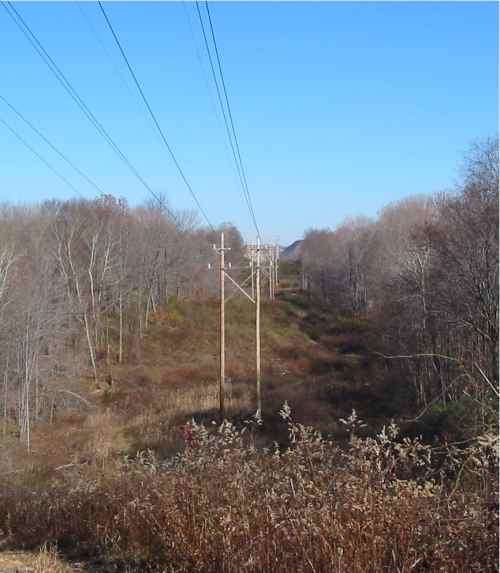
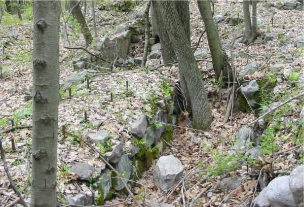
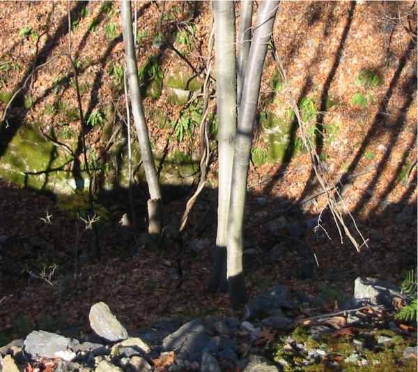
Power lines cut through the long axis of the park and over the start of the marked trails at the site. Like most postcolonial mines of the state, the site is littered with ore debris of field stone (granite) and ore (magnetite). Some of the debris is arranged to form walls or divides, or perhaps just used to fill in gullies.
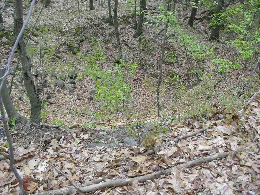
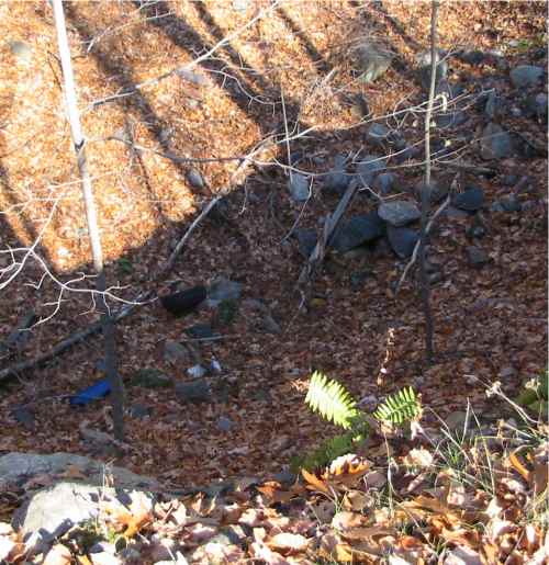
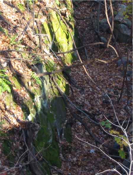
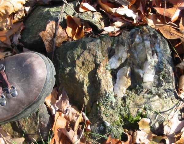
The ore here was high-grade, 80% iron, and some parts are magnetic. There are several small and large mine sites here. The mine entrance sites are now just pits where mine entrances have collasped. Here's the surface profile of another pit - some of these are tens of feet deep and just as wide. They are too steep and wet to enter; and of course the shafts themselves are extremely dangerous.
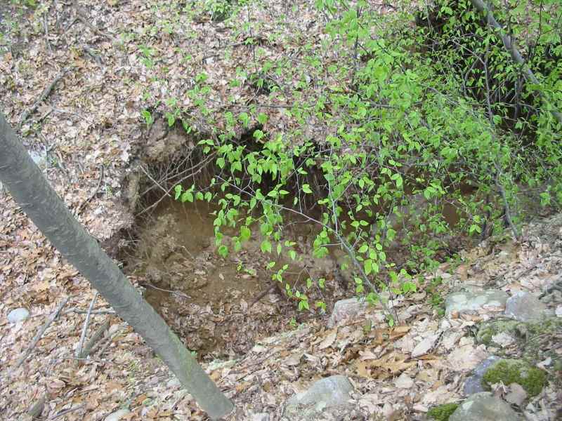
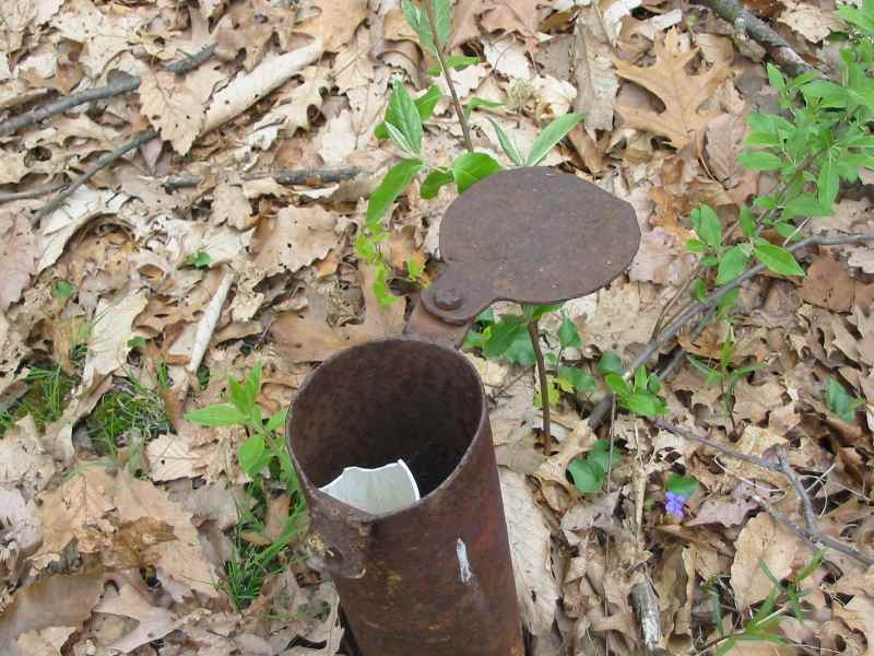
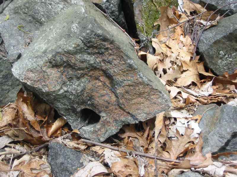
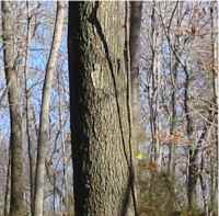
The western side of the site seems to be mostly debris and pits, with only a few artifacts to show industrial use, such as this pipe vent in the ground and this drilling hole in this rock. Some kind of equipment was apparently mounted on this stony area with half-inch metal bolts sticking up; probably a pump to remove water or to pump air.
These photos are from Nov 2005
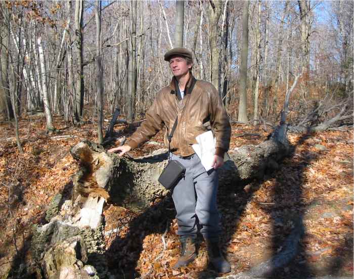
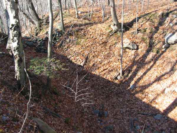
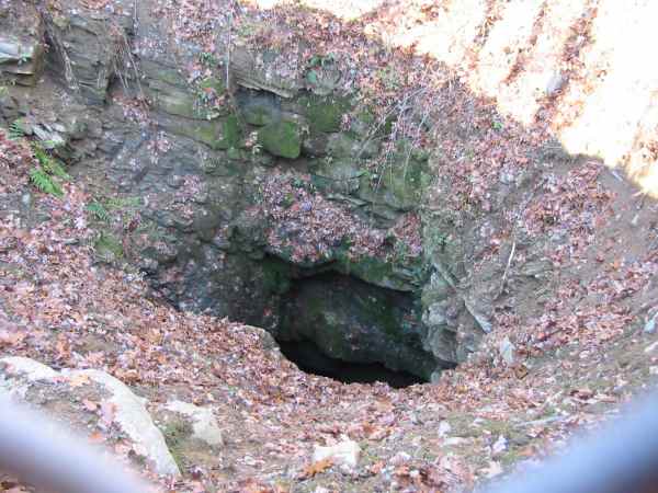
I hiked the site along the eastern trails in mid-Nov 2005 with my colleage Wayne Petko. We explored the eastern end, the blue trail and the white trail. They look similar to the red trail. The trail runs along the line of pits of former mine shafts such as this one. You can't appreciate the size and depth of these from photos, but this photo shows a tire at the bottom. Other pits along the iron vein are about as big,
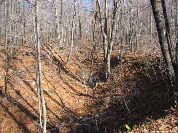
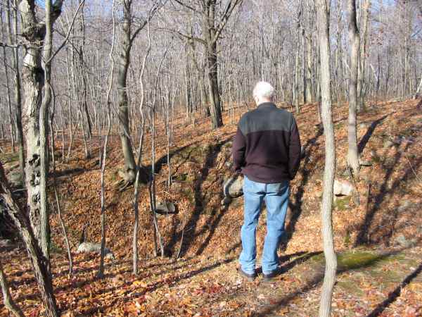
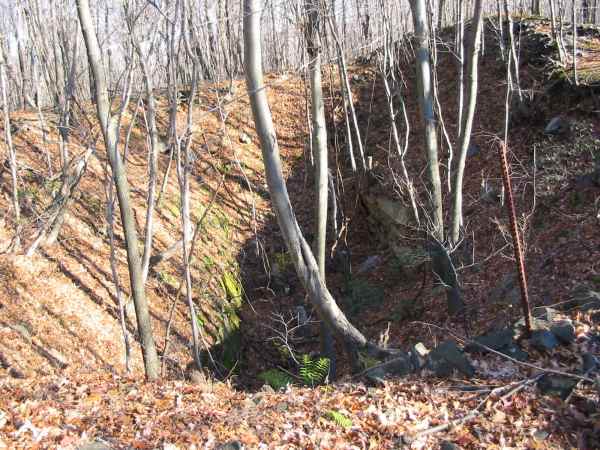
such as this one; again to see the scale of it, here's my friend at the edge of it. Further along is this pit; the interior rocks of the pit have a lot of moss and also show the original structure of the opening. This
image from the side gives some idea of steepness and depth.
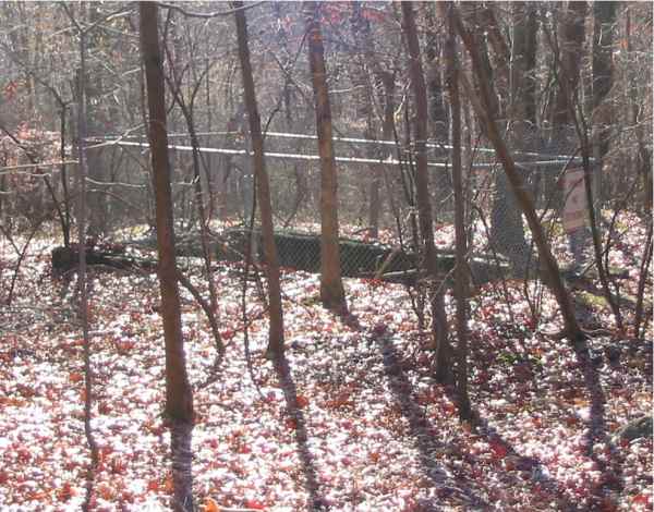
Some of the mines at this end are less degraded, such as this fenced in pit. Another
fenced-in pit seems mostly an intact opening. The scale of the opening is deceptive: the opening is several feet wide and maybe 20-30 feet down. [Later I was told this entrance was the Elizabeth shaft for the Mount Hope mine - hundreds of feet deep. - Herb.]
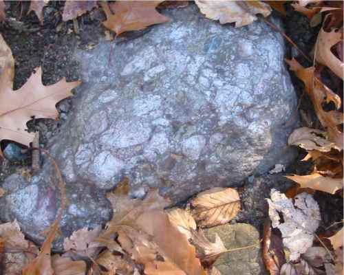
Not all of the minerals are iron. Here's a rock with embedded quartz in pink.
Here's a rock with some crystaline quartz. The site is also a nature preserve;
here's some rushes in the marsh area at the southeast corner of the park.
Since this Web page was created in 2007, I've been contacted by descendents of miners
and former residents of the Mount Hope & Richard Mine area. Also, enthusiasts for mining sites, hiking and geology. Here's a link to a Web page of their comments and information, and some Web links. In 2012 I gathered some Web links that may be helpful to people interested in the miner's histories. If you find other Web sites or organizations of relevance, let me know. - Herb Johnson
- a document of references about mining in Morris County
- Morris County Heritage Commission, more references They've worked on preservation, such as the Mt Hope Miner's Church building.
- The Historical Society of the Rockaways
- an on-line article about mines in the area including the Richard
- Rockaway Township Free Public Library
- subject search "iron mines and mining" yields 63 books about mines in
the area, in North Jersey, including histories. some are on microfiche.
- a capsule history of Rockaway Township including the Richard Mine.
- Morris County Park Commission which is responsible for Mt. Hope County Park.
There are likely on-line resources for local cemeteries, and for genealogy resources like birth and death certificates, and so on. You can do Web searches for that stuff, specific to your interests.
- Herb Johnson
Copyright 2012 Herb Johnson. All rights reserved. Last updated Nov 9 2012.
Contact information:
Herb Johnson
New Jersey, USA
To email @ me, look at my commercial Web page for address
Copyright © 2012 Herb Johnson